Colorado weather: Storms bringing several feet of snow to ski resorts just in time for Christmas
Remember when Colorado ski resorts were starving for snow only two weeks ago and some folks were beginning to wonder if this winter was going to be a bust for skiers and snowboarders?
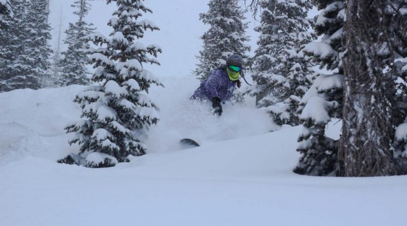
Worry no more. Christmas will come early for snow riders when the first of a long series of storms bombards the Colorado high country beginning Wednesday night or Thursday. According to Joel Gratz, founding meteorologist at OpenSnow, a whole lot of snow is coming over the next 10 days, with some areas likely to receive more than five feet. The lengthy storm cycle appears to be just what Colorado resorts have needed so desperately.
“The new snow should help most mountains open most of their terrain by around New Year’s,” Gratz wrote in Tuesday’s forecast.
It looks like the storm cycle will favor southern and central mountains including Wolf Creek, Purgatory, Silverton, Telluride, Crested Butte, Monarch, Aspen Snowmass and Powderhorn. Steamboat may do really well, too.
“The mountains close to I-70 will likely get less, but still significant snowfall,” Gratz wrote. “Snow totals during the next 10+ days should range from 1-2 feet on the low end to 5+ feet on the higher end.”
The top five-day forecasts by OpenSnow call for 36 inches at Wolf Creek, 30 at Crested Butte, 28 at Purgatory and 26 at Steamboat. Closer to Denver, OpenSnow predicts 16 at Beaver Creek, 15 at Vail, 13 at Loveland and Rocky Mountain National Park, 11 at Arapahoe Basin, 10 at Copper Mountain and Breckenridge, nine at Keystone and eight at Winter Park. And there’s more snow coming after that.
Weather forecast models are making it difficult to predict the timing of the storms, Gratz wrote, but there’s no doubt about their abundance.
“All I can say at this point is to gear up for plenty of snow and be ready to ride as many days as possible,” Gratz wrote. “Snow quality could be thick and dense, at least during the first few days of the storm cycle later this week and over the weekend. The thick snow will be thanks to strong winds and warm temperatures. We’ll take the water and the base-building accumulation for sure. If cooler air works in from time to time, snow quality will become fluffier.”
Longer-term forecasts are encouraging as well.
“Not only do models show that storminess will continue into the first few days of 2022, but both the European and American GEFS models show that the stormy pattern will continue for most of January as well,” Gratz wrote. “I do not trust any specific weather forecast weeks in advance, but we can place some trust in forecasts for the general weather pattern weeks in advance.”
Subscribe to our weekly newsletter, The Adventurist, to get outdoors news sent straight to your inbox.
Source: Read Full Article